AERIAL VIDEO
Colorado Aerial Photography and Mapping can produce stabilized, high definition aerial video up to 4K resolution (Ultra High Definition).
AERIAL VIDEO SERVICES
Colorado Aerial Photography and Mapping can produce stabilized, high definition aerial video up to 4K resolution (Ultra High Definition) using our unmanned aerial platform.
The uses for aerial video are numerous.
Aerial Video Uses
Examples of aerial video uses include:
Construction sites, events, real estate flyovers, aerial mapping, roof inspections, power line and utility inspections, damage survey, irrigation analysis, wildlife surveys, traffic survey, road and infrastructure planning, bridge inspection, crop analysis, television advertising, demolition projects, disaster site analysis, golf course advertising, auto dealer advertising and construction planning.
The possibilities are endless and our clients are discovering new uses for our aerial video capabilities every day.
Our airborne camera is gimbal stabilized producing very steady and clear video of the highest quality available in an unmanned airborne system.
Getting Started
The typical project for us starts with an in-depth phone conversation identifying the client’s needs. In most cases all we need is a physical address of the subject, but a readily available satellite image such as Google Earth or Apple Maps is helpful. We will then fly on the next available day with suitable weather for the project. When we return to the office, the editing and production process begins. Depending on the scope of the project, this can take as little as a day or up to several days. We are able to deliver the video to most clients within a week, but for a large project this could take longer.

Video Editing
Many clients have an in-house production department that perform the editing and final production of the video that we capture. We offer video editing services for those clients without the capability or time to do this for themselves.
Billing
We do not require a deposit to get started. Billing is done via invoice on a net 30 basis. We accept check or credit card payments as well as Pay Pal.
The Extra Mile
Colorado Aerial Photography and Mapping has a company pilot that is FAA licensed for all of our operations and fully insured. We understand the importance of our video imagery to your business and will always prioritize safety, quality and consistent customer service.
Licensed Airline Pilot
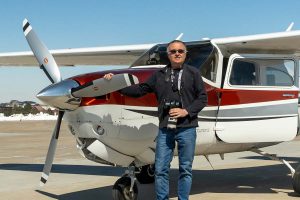 Colorado Aerial Photography & Mapping is owned and operated by Kent Raney. Kent has been a professional aerial photographer since 2003.
The company is headquartered in the Denver, Colorado area and provides high quality aerial photography services in the Rocky Mountain and high plains regions. Nationwide service is available through our affiliation with a network of other professional aerial photographers.
Kent is an FAA licensed Airline Transport Pilot with over 37 years of flying experience and is also an FAA certified UAS pilot, which allows him to operate drones for commercial purposes under Federal Aviation Regulations part 107.